Bihar Land Survey – What’s Happening and Why It Matters
Ever wonder why you keep hearing about the Bihar land survey in the news? The state government has launched a massive drive to map every parcel of land, update ownership records, and resolve disputes. For farmers, property owners, and anyone dealing with land in Bihar, these changes can mean clearer titles, better access to loans, and fewer conflicts.
In simple terms, a land survey is a technical process that measures the exact size and boundaries of a piece of land. Bihar’s recent push covers everything from tiny village plots to large commercial farms. The aim is to create a digital database that everyone can trust.
Why the Survey is a Game‑Changer for Farmers
Many farmers in Bihar still rely on handwritten documents that are prone to errors or loss. The new survey will digitise these records, making them easier to verify. With a solid land title, a farmer can approach banks for agricultural loans, get subsidies, or even sell land without legal hassles. The state claims that the updated records will also help the government plan irrigation projects and road building more efficiently.
One practical tip: once the survey is complete in your area, you can check your land’s status online through the official Bihar Land Records portal. All you need is your plot number and a few personal details. If you spot a mistake, you can file a correction request right on the platform – no need to stand in long queues.
Key Steps the Bihar Government Is Taking
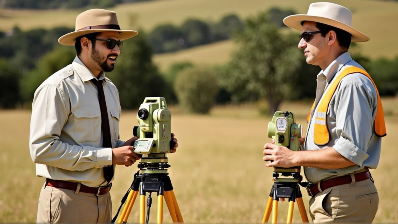
1. Deploying Survey Teams: Over 3,000 field teams equipped with GPS devices are on the ground. They visit every village, record coordinates, and photograph boundaries.
2. Integrating Satellite Data: High‑resolution satellite imagery is being used to cross‑check the on‑site measurements. This reduces human error and speeds up the process.
3. Community Involvement: Local panchayats are asked to verify the data before it goes live. Residents can raise objections if they see any discrepancy.
4. Public Access: The final database will be available to the public for free. You’ll be able to download a PDF of your land record or view it on a map interface.
5. Legal Back‑up: The state is simplifying the process to get a certified copy of the updated record, which can be used in courts if needed.
These steps aim to cut down the years‑long disputes that have plagued Bihar’s rural areas. When everyone trusts the numbers, there’s less room for conflict.
It’s also worth noting that the survey isn’t just about ownership. The data will help identify land that’s suitable for new roads, schools, or renewable energy projects. That means better infrastructure for you and your community.
So, how can you stay in the loop? Keep an eye on local news portals like NewsBuzzIndia, follow the Bihar Land Records department on social media, and attend panchayat meetings where survey updates are discussed. The more you know, the better you can protect your rights.
In short, the Bihar land survey is a massive effort to bring transparency, boost the economy, and give landowners the confidence they need. Whether you’re a farmer, a business owner, or just a curious citizen, the upcoming changes will likely affect you. Stay informed, check your records, and use the new system to your advantage.
The Bihar land survey process keeps changing, and the latest directive targets crucial steps in property mutation. While survey deadlines now stretch to December 2026, people are watching to see when and how property ownership records will be updated. Here’s what the new move could mean for landowners.