Relentless rain has slammed North and Central India, flooding towns, crippling highways, and forcing evacuations from Punjab to Delhi and western Uttar Pradesh. The India Meteorological Department has issued a IMD red alert for several states as swollen rivers and broken drains pour into low-lying areas. Punjab is staring at its worst floods since 1988. In Delhi-NCR, a breached drain near the Haryana border pushed water into residential colonies, sending families to temporary shelters overnight.
Authorities say the current spell is powered by a monsoon low-pressure system over the northwest Bay of Bengal that is strengthening and dragging deep moisture inland. The result: hours of intense rain stacked on already saturated ground, setting up classic conditions for flash floods, landslides, and urban waterlogging.
What the IMD is saying and why this is happening
The IMD has issued red alerts for Himachal Pradesh, Uttarakhand, Chhattisgarh, Odisha, Gujarat, and Madhya Pradesh. Red means take action now—very heavy to extremely heavy rain is likely in parts of these states, with a risk to life and infrastructure. In plain terms, some pockets could see more than 20 cm of rain in a single day. That’s enough to submerge ground floors, trigger hill slopes, and cut off roads.
Here’s the meteorology in brief. A low-pressure area has formed over the northwest Bay of Bengal and is expected to intensify into a depression as it crawls inland. When that happens, it acts like a moisture pump, pulling in warm, humid air from the sea and lifting it over land. Combine that with a southward-shifted monsoon trough and orographic lift over the Himalayas, and you get long, intense bursts of rain over the same zones. That’s why hills and the plains just south of them are getting hammered all at once.
The IMD notes heavy to very heavy rainfall is persisting over the Western Himalayan Region—mainly Himachal Pradesh and Uttarakhand—as well as Punjab and Haryana. The agency expects a notable dip in intensity in these areas after the current core of the system moves. But as the circulation tracks west-northwest, the focus turns to central India, including Madhya Pradesh and Chhattisgarh, and further into Gujarat and parts of eastern India like Odisha.
Rainfall categories matter for planning. The IMD classifies daily totals roughly as heavy (6.5–11.5 cm), very heavy (12–20 cm), and extremely heavy (21 cm or more). Once you hit those top two bands in hilly terrain or crowded cities, the odds of slope failures, drain overflows, and transport shutdowns jump fast.
For September, the IMD’s monthly outlook points to above-normal rainfall—more than 109% of the long-period average of 167.9 mm. That means even after this spell eases in some pockets, the ground will stay wet and sensitive. One more strong system could be enough to tip already stressed districts back into crisis.
Where the damage is showing up—and what to watch next
Punjab, Himachal Pradesh, Haryana, Delhi-NCR, western Uttar Pradesh, and pockets of Jammu and Kashmir are the current hotspots. Each has a different risk profile—hills face landslides and road cuts; cities are dealing with knee-deep street floods; rural belts are watching embankments and local drains with worry.
- Punjab: Officials describe these floods as the worst since 1988. Rivers and drains are swollen, rural roads are cut in stretches, and fields are waterlogged. With inflows still high and more rain upstream, communities along canals and distributaries remain on alert. Restoring farm-to-market connectivity will take time once waters begin to recede.
- Himachal Pradesh: The state has declared itself disaster-affected. Steep slopes saturated by days of rain are prone to slides, mudflows, and rockfall. Mountain highways and link roads—especially those hugging valleys—can shut without warning. Even when the rain pauses, debris loosened by earlier downpours can come down later.
- Uttarakhand: The IMD warns of landslides and flash floods in the hill districts. In river valleys, short, intense cloudbursts drain rapidly into narrow channels, which is why seemingly calm streams can surge within minutes. Pilgrim routes and high-altitude tracks are especially vulnerable.
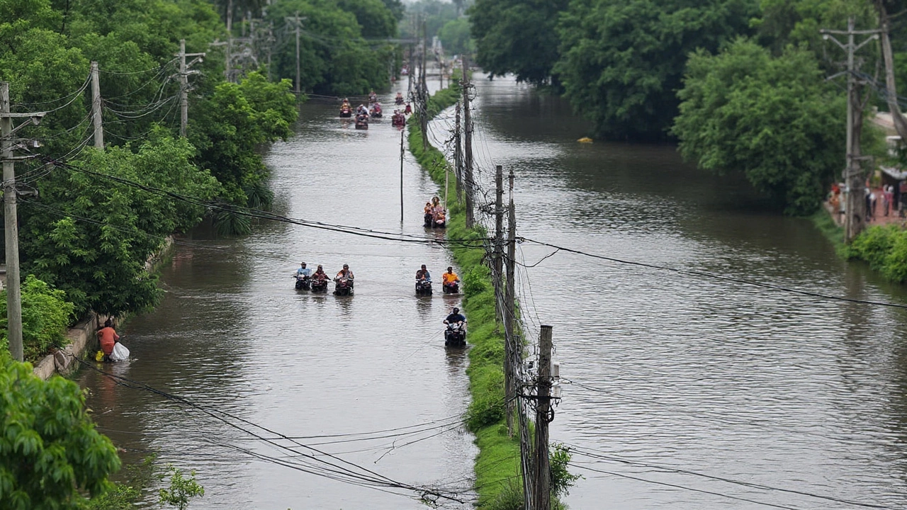
- Delhi-NCR and Haryana: Unusual, prolonged showers drowned underpasses and key roads in Gurugram. A damaged structure near Kadarpur in Sector 63 A let water into nearby areas, worsening jams and flooding. Separately, a breach in the Mungeshpur drain near Bahadurgarh allowed water to push into Delhi’s fringe colonies close to the Haryana border. Delhi Chief Minister Rekha Gupta spoke with Haryana Chief Minister Nayab Singh Saini seeking immediate repairs. Around 2,000 people were moved to shelters set up at Baba Haridas Temple and an MCD school in Jharoda as a precaution.
- Jammu and Kashmir: Rescue teams have been working to evacuate stranded residents in and around Garkhal, Pargwal, and Khiur in the Akhnoor sector. The Chenab was reported at around 43.5 feet—above the evacuation threshold—before easing, while the Tawi dropped to about 13 feet, below its danger mark. Even as levels fall, saturated banks and fast currents keep risks high near bends and bridges.
- Central and Eastern States: As the low-pressure system intensifies and drifts inland, heavy rain is spreading into Madhya Pradesh, Chhattisgarh, Odisha, and later into Gujarat. Coastal Andhra Pradesh, Telangana, and south interior Karnataka are also in line for strong spells, especially on the system’s southern flank where low-level winds feed in moisture from the sea.
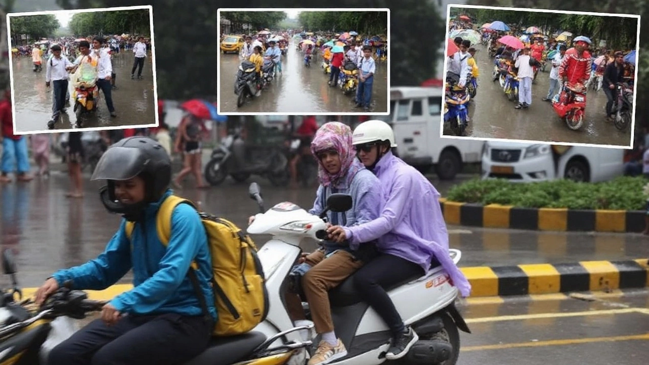
Transport disruptions are widespread. City buses and cabs are being rerouted around submerged underpasses in NCR. In the hills, hairpin stretches and newly cut slopes are the weak links. Trains can slow or halt when tracks get submerged or embankments look suspect, and smaller airports face visibility issues and runway waterlogging during peak bursts.
Urban flooding is a story of speed. Most Indian cities have paved over open ground that once soaked up rain. When drains choke with silt or plastic and rain comes down in sheets, water has nowhere to go but sideways into homes and markets. Add a breached drain or a backflow from a river, and entire neighborhoods can go under within an hour. That’s why even short breaks in rain are used to pump out water, clear inlets, and move people to higher ground.
In the hills, the pattern is different but just as dangerous. Soils that look firm can fail after repeated soaking. A sunny morning after a storm can tempt drivers back onto winding roads, but slopes remain primed to slide. The most dangerous stretches are cut into recent debris or along cliffs where seepage undercuts rock. Officials often close roads not because of what’s falling at the moment, but because of what could come down next.
Here’s the near-term outlook based on current IMD guidance:
- Heavy to very heavy rain will continue in parts of the Western Himalayan Region, Punjab, and Haryana in the immediate term, with the intensity likely to ease as the system shifts.
- Central India—Madhya Pradesh and Chhattisgarh—will be in the firing line as the low-pressure area matures into a depression and migrates inland.
- Odisha and adjoining coastal belts will see strong bands on the eastern and southern arcs of the system, with localized extreme rain possible where bands stall.
- Gujarat and north Maharashtra could see spillover effects depending on the system’s final track and how quickly it weakens over land.
Recent observations match the forecast. Extremely heavy rain—21 cm or more in 24 hours—has been recorded at isolated locations in Jammu and Kashmir and West Madhya Pradesh. Very heavy rain has also turned up in pockets of Himachal Pradesh, Uttarakhand, Punjab, Haryana, West Uttar Pradesh, and Chhattisgarh. When you see those numbers across multiple states at once, it means the monsoon engine is running hot and broad.
What should residents do right now? Treat red alerts as action prompts, not headlines. If you live near a drain, canal, or nallah, assume a margin of extra rise and move valuables to higher shelves. Park vehicles away from basement ramps. In hill districts, avoid night travel, and do not stop under freshly cut slopes. If a road is closed, it’s usually because the next bend is the problem—not the one you can see.
For those in cities, watch the usual waterlogging spots in your neighborhood. It takes one clogged gulley to flood a block. Keep phones charged, fill a few bottles of clean water in case pumps go off, and keep medicines in a waterproof pouch. Use public advisories for diversion routes instead of experimenting with side lanes that can dead-end in deeper water.
For farmers and field workers, pause non-urgent work in low-lying plots until runoff stabilizes. Freshly ploughed fields can erode fast under pounding rain. In riverine belts, cattle sheds and feed stocks should be moved to higher, firmer ground. Once the rain tapers, check for seepage around village embankments and culverts—these weak points show up first.
Administrations are racing on multiple fronts: plugging breaches, pumping out underpasses, reinforcing embankments, and keeping shelters ready. Evacuations around the Mungeshpur drain breach show how quickly such decisions must be made when water levels jump. These are hard calls, but they save lives when the next downpour hits faster than repairs can be finished.
The big picture: September is running wetter than usual, and the ground across large parts of North and Central India is already soaked. That means fewer second chances. The coming days hinge on how fast the Bay of Bengal system intensifies and where it tracks after landfall. A slight shift can spare one district and flood another. Keep an eye on local bulletins, and take warnings seriously even if the sky looks calm for an hour or two. In this kind of pattern, the next band can arrive faster than you think.