IMD flags wet September for Jammu & Kashmir
Jammu & Kashmir is staring at a wetter-than-usual September. The India Meteorological Department (IMD) has projected above-average rainfall for the region, warning that short, intense spells could trigger flash floods and landslides across vulnerable slopes and stream channels. That means more instability on mountain roads, sudden rises in water levels, and frequent travel disruptions just as the monsoon usually begins to wind down.
Why this matters now? The hills are already moist after weeks of monsoon rain. When fresh downpours hit steep terrain, the soil can give way without much warning. In districts like Ramban, Doda, Kishtwar, Udhampur, Rajouri, and Poonch, even a one-hour burst can bring a slide onto the highway or send a torrent through a narrow valley. The Kashmir Valley is not spared either—low-lying pockets near the Jhelum and its tributaries can collect water quickly, and smaller streams can swell with little notice.
IMD’s outlook points to active monsoon phases nudged by western disturbances and a southward-shifting monsoon trough. That setup often funnels moisture from the Arabian Sea into the Pir Panjal and the higher ranges, where orographic lift squeezes out heavy rain. On paper, that sounds technical. On the ground, it means localized cloudbursts, sudden downpours in pockets, and uneven rain distribution: one village gets drenched while the next sees a light drizzle.
Color-coded alerts—yellow for be aware, orange for be prepared—are likely through several windows this month, especially around mid-week transitions when systems interact. Expect advisories for the Jammu–Srinagar corridor (NH-44), sections near Banihal and Ramban, and feeder roads to remote valleys. Mughal Road can also face closures when slopes become slushy. Air traffic at Srinagar and Jammu airports could see delays when low clouds and poor visibility set in.
River basins to watch include the Jhelum, Chenab, and Tawi, along with their fast mountain tributaries. Flash floods in upper catchments can push sudden surges downstream, sometimes hours after the rain has stopped where you are. Hydropower projects and reservoir operators usually step up monitoring during such periods; precautionary releases are possible, which can influence river levels further downstream. People living near active stream channels should keep a close eye on official advisories, especially at night.
Tourism and pilgrim movement add another layer. The Katra track to Vaishno Devi can turn slippery, and hillside shortcuts become hazardous. Trekking routes in Sonamarg, Pahalgam, and Gulmarg see quick weather shifts. If you have bookings, build in buffer time; the safest plan is to travel during daylight and stick to marked paths.
Risks, preparedness, and what residents should watch
The big risks are straightforward: slope failures, debris flows, and sudden water surges. Known slide-prone spots—particularly along cut slopes on NH-44—demand slow driving and patience. Don’t gamble with narrow windows between road openings; one short burst of rain can close a freshly cleared stretch again. For those near nallahs and hill streams, keep valuables and documents in waterproof folders and store them higher than the usual flow line.
For farmers, this rain is a mixed bag. In the Jammu plains, late monsoon showers can help paddy at certain stages, but waterlogging damages nurseries and delays field operations. In the Valley, apple harvests pick up through September; heavy rain can bruise fruit, loosen tree anchors in soggy soil, and delay transport. Basic steps help: harvest when breaks in the weather appear, use crates instead of sacks for transport, and avoid stacking boxes high on wet ground. Orchardists should also watch for fungal issues after wet spells and schedule sprays during dry windows.
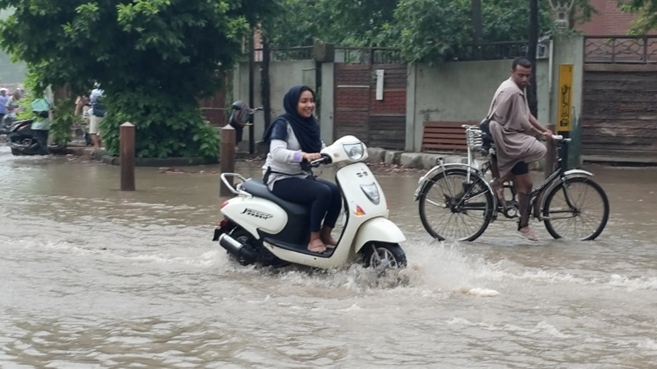
The infrastructure strain is predictable. Power lines on unstable slopes, rural roads with poor drainage, and culverts clogged with debris tend to fail first. Panchayat teams and local PWD units usually clear drains before heavy spells—if you spot a blocked grate, flag it early. Urban neighborhoods in Jammu city and Srinagar see quick waterlogging when intense rain overwhelms drains; parked cars in low stretches often take the first hit, so shift them to slightly elevated lanes when a strong spell is forecast.
For schools and offices, decisions usually track the intensity of alerts. Don’t wait for a last-minute call if you know your route crosses a known bottleneck; plan remote work or staggered timings on days with orange warnings. Many workplaces in the region now keep contingency rosters during the monsoon to avoid late-night commutes on risky roads.
Transport services typically adjust in real time. The highway authority may allow convoy-style movement between landslide zones. Railways monitor vulnerable cuttings and bridges after heavy spells; temporary timetable changes are common in such weather phases. If you rely on day trips for trade, budget extra time and keep cashless payment options ready—mobile networks sometimes stumble when towers lose power in isolated pockets.
Tour operators are advising flexible itineraries. The sensible approach is to prioritize safety stops over “must-see” lists. If your driver suggests waiting out a cell of heavy rain, take that advice. A 30-minute pause can be the difference between a clean run and being stuck behind a fresh slide for hours.
What should households do now? Simple, low-cost steps go a long way:
- Save emergency contacts and local helpline numbers on paper and phone. Keep a small battery bank charged.
- Stock a basic kit: drinking water, a torch, a small first-aid box, and dry snacks.
- Move important documents and electronics to higher shelves. Use zip bags or plastic folders.
- Avoid parking under unstable cut slopes or under trees with exposed roots.
- During downpours, keep kids and elders away from stream banks and culverts; water rises fast and silently in these channels.
- On highways, don’t tail heavy vehicles in slide-prone zones—stones often roll off slopes after the main rain stops.
Public messaging will matter this month. The IMD app and district disaster management updates usually give enough lead time to change plans, but the warning language can feel technical. Focus on the color codes and district-wise alerts. Yellow means stay informed; orange means actively change your plans to reduce exposure. If a red alert is issued for your area, avoid non-essential travel, especially after dusk.
Recent monsoons have shown how quickly conditions can flip in the mountains. A sunny morning often ends with a late-afternoon burst that triggers multiple slides within minutes. That pattern is likely to repeat as September stays wetter than average. Localized cloudbursts are hard to predict precisely, but the larger signal—more moisture, more instability—is clear.
For now, the takeaway is simple: plan with margins, trust official alerts, and respect the terrain. If you live along a slope or a stream, your best defense is preparation and quick response. If you’re traveling, pick daytime windows, carry essentials, and build slack into your schedule. And if you’re managing orchards or fields, align your operations with the dry breaks and avoid risky movements during peak warnings.
The monsoon will ease eventually, but not before a few more testing spells. With informed choices, communities across the region can stay ahead of the curve. Keep an eye on the forecast, listen for local advisories, and treat this as a high-alert month for Jammu Kashmir rain.