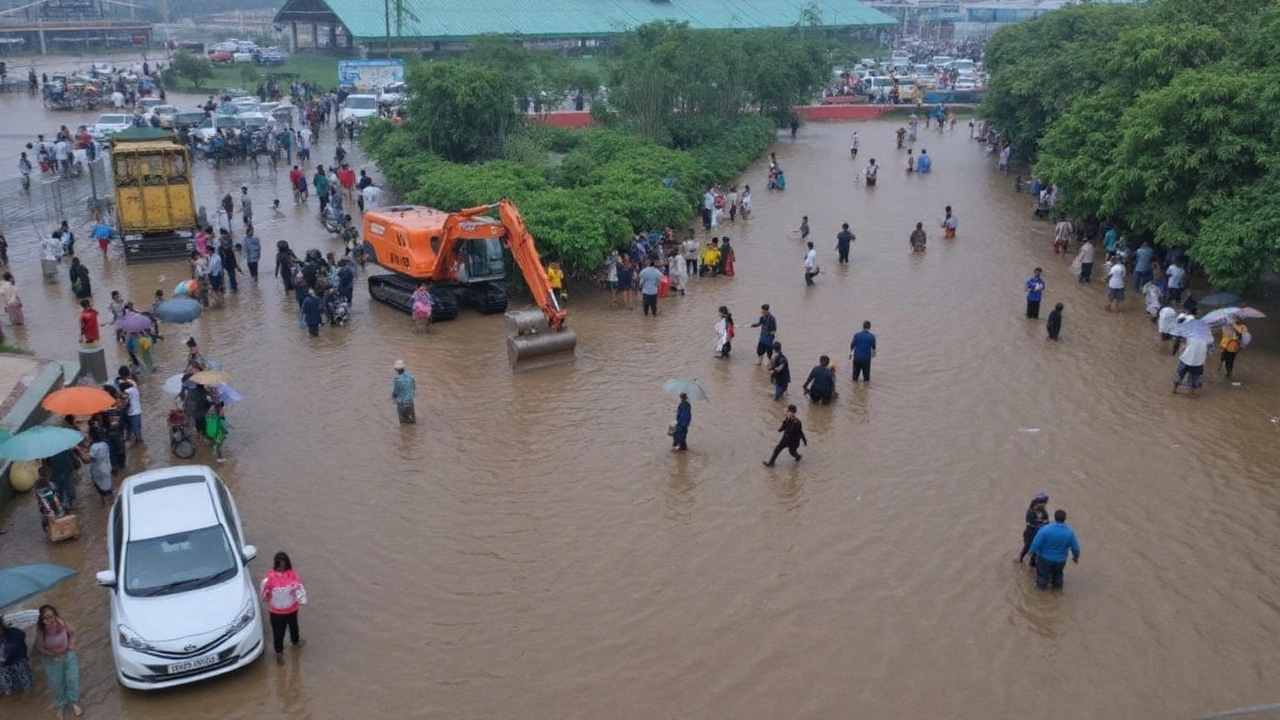
A few centimetres stood between Delhi and a new high-water mark on Wednesday night. The Yamuna touched 207.44 metres—just 5 centimetres short of the 1978 flood peak of 207.49—after daylong downpours flooded roads, paused cremations at Nigambodh Ghat, and slowed the capital to a crawl. It was the second straight day above the 207-metre evacuation mark, and the fifth time since 1963 that the river has crossed this threshold.
While heavy showers tapered off late in the day, the India Meteorological Department (IMD) said the wet spell is not done yet. A red and orange alert cycle in the morning softened to a yellow alert by evening as intensity dropped, but conditions stayed unstable. The city stayed cooler than usual—32.3°C at the peak and 22.8°C at the low—under thick cloud cover and south-easterly winds that gusted up to 30 kmph.
The scale of this monsoon stands out. Delhi has already logged over 1,000 mm of rain this season, far beyond the city’s annual average of 774 mm. That kind of excess loads storm drains, overruns low-lying stretches, and, critically, pushes the Yamuna toward danger levels even if a particular day brings lighter rain.
River on the brink: what the numbers mean
Crossing 207 metres is not just a statistic—it’s the evacuation trigger. At this level, river water can back up into storm drains, seep into floodplains, and flood riverbank facilities. Nigambodh Ghat, Delhi’s oldest cremation ground, had to suspend cremations after the river breached its banks and inundated the premises. Officials kept watch along embankments as the level hovered close to the 1978 mark, a line etched into the city’s memory for the damage it brought.
The Yamuna’s level in Delhi often depends on two things: local rain and inflows from upstream, including releases at the Hathnikund barrage in Haryana. That’s why the river can keep rising for a while even if it stops raining in central Delhi. Residents in low-lying pockets along the floodplain—areas near the bridges and the riverbed—reported waterlogging and backflow into lanes through the afternoon.
Police and traffic teams moved to keep people away from risky stretches. Movement on the Outer Ring Road from Majnu Ka Tila to the Salimgarh Bypass was heavily hit by the swelling river. Diversions were enforced from the Wazirabad–Signature Bridge side and from Chandgi Ram Akhada towards the IP College traffic light. The advice was simple: avoid the riverfront corridors and take alternate routes where possible.
Air travel felt the pinch too. By 5 pm, 273 departures and 73 arrivals at Delhi airport had been delayed as airlines warned of weather-related disruption. SpiceJet issued an advisory, and more carriers cautioned passengers to plan for longer ground times. A key approach stretch near IGI Airport was waterlogged, adding to gridlock on arterial roads connecting the terminals.
Gurugram had its own share of flooding, with several main roads submerged and office zones reporting prolonged jams. In Noida and Ghaziabad, patchy but intense bursts of rain triggered snarls at underpasses and low-lying junctions, even as lull periods made the day feel like a stop-start commute.
- Delhi rainfall advisory for flyers: check your airline app before leaving; expect queues at security; build in extra travel time to reach the terminal; carry essentials in cabin baggage in case of extended delays.
- For commuters: avoid waterlogged underpasses; stick to main corridors that drain faster; do not drive through standing water if you cannot see the road surface; keep fuel tanks topped up during this stretch of unsettled weather.
City services were stretched through the day. Pumping teams worked on flooded underpasses and key junctions, while enforcement staff managed choke points around river bridges. Power utilities said they were on alert for outages in low-lying colonies, a standard precaution when water levels rise quickly near feeder lines and junction boxes.
Despite the rain, the air stayed relatively clean. The Central Pollution Control Board’s 4 pm reading placed the AQI at 57, in the “satisfactory” band—typical when strong winds and showers wash out suspended particles. As skies turn partly cloudy after the main spell, the AQI trend bears watching, but for now, dust and smoke levels remain manageable.
What the forecast says through the week
IMD expects a mostly cloudy Thursday with the chance of very light to light rain or thunderstorms. Temperatures are likely to range between 24°C and 33°C. There is a possibility of moderate rain at isolated spots on Friday. The broader outlook points to on-and-off showers until September 7, with cloud cover likely until September 9.
Neighbouring districts will share the load. Noida and Ghaziabad are under a yellow alert for light rain and thunderstorms. Gurugram has an orange alert, indicating a higher chance of moderate rain. IMD has also flagged isolated heavy rain over parts of Haryana and Chandigarh, which matters for Delhi because upstream rain can feed into the Yamuna.
There were no fresh severe weather alerts issued for the rest of the week as of Wednesday evening, but unsettled conditions can flip quickly. That means keeping an eye on river bulletins and avoiding riverfront areas until the Yamuna drops well below the evacuation line.
For those living or working near the river and in flood-prone pockets, a few simple steps can prevent a bad day from getting worse:
- Keep essential documents, medicines, and chargers in a waterproof pouch if you live in low-lying areas.
- Do not step into flowing water; use firm footing and stick to well-lit, busy corridors.
- Avoid parking along the riverbed, under flyovers near the river, or next to storm-drain outlets.
- Unplug non-essential appliances at ground level if water begins to enter your building.
- Follow police diversions even if the detour looks longer; flooded shortcuts can stall traffic for hours.
- Track IMD and local advisories for quick changes in alerts and river levels.
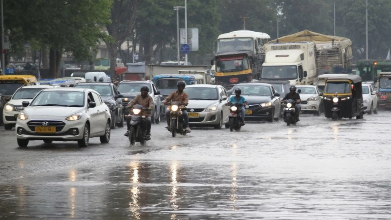
Wednesday’s weather also reset the city’s rhythm. School runs, office commutes, and deliveries all slowed as water pooled at familiar trouble spots. Restaurants and markets saw thinner evening crowds, with many people choosing to stay in and wait for the rain bands to pass. Public transport kept the city moving, but road-based services ran into delays wherever waterlogging lingered.
The coming days will be about patience and planning. With soils saturated and drains running full, even a short burst of rain can tip roads back into waterlogging. Give yourself extra time, stay off the riverfront, and watch the Yamuna number: the difference between 207.44 and 207.49 metres is tiny on paper, but it’s the gap between a tough week and a dangerous one.